Does this barren red landscape look familiar? It's a fairly common sight throughout the old goldfields of Victoria.
During the gold rush, miners stripped large areas of shallow gold-rich ground down to the bedrock and processed the earth they removed using equipment such as tubs, cradles, puddling machines and sluices.
This method of mining is known as "paddocking" or "surfacing" and evidence of it can be found in abundance throughout the Victorian Goldfields.
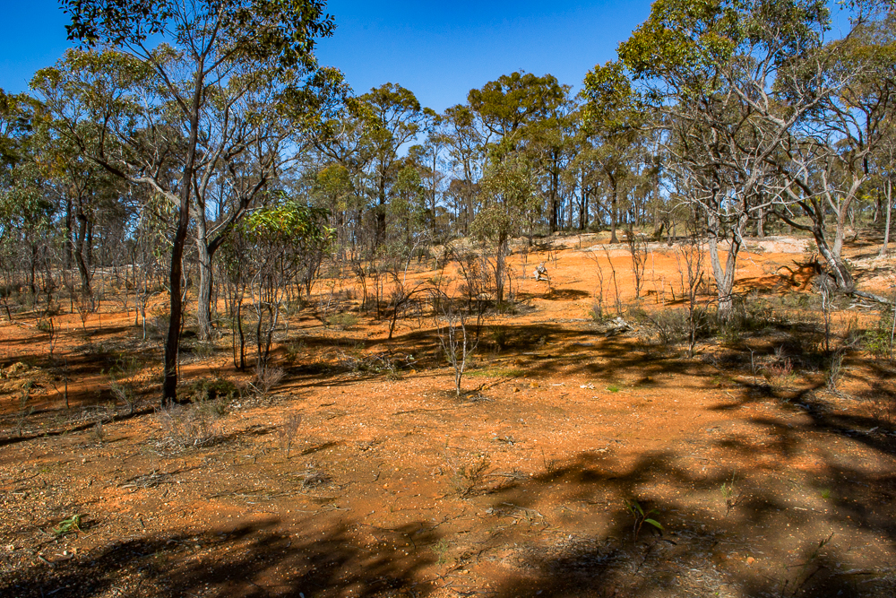
The surface here has been stripped down to bedrock.
These areas were excavated by hand, a remarkable testament to the sheer determination of the diggers.
Due to the labour involved in removing and washing such large quantities of earth, the ground here had to be rich enough in gold to make the effort and processing costs worth while.
Surfaced areas are of interest to modern day gold prospectors for this reason - there was gold here, and lots of it!
"150 to 200 persons are busily engaged surfacing. Some very excellent finds have taken place, several having already arrived at pounds weight. The depth is not more than two feet, and most of the ground is taken up. There can be no doubt but that many such patches still exist." Wednesday 28th May, 1856 (Source: Trove)
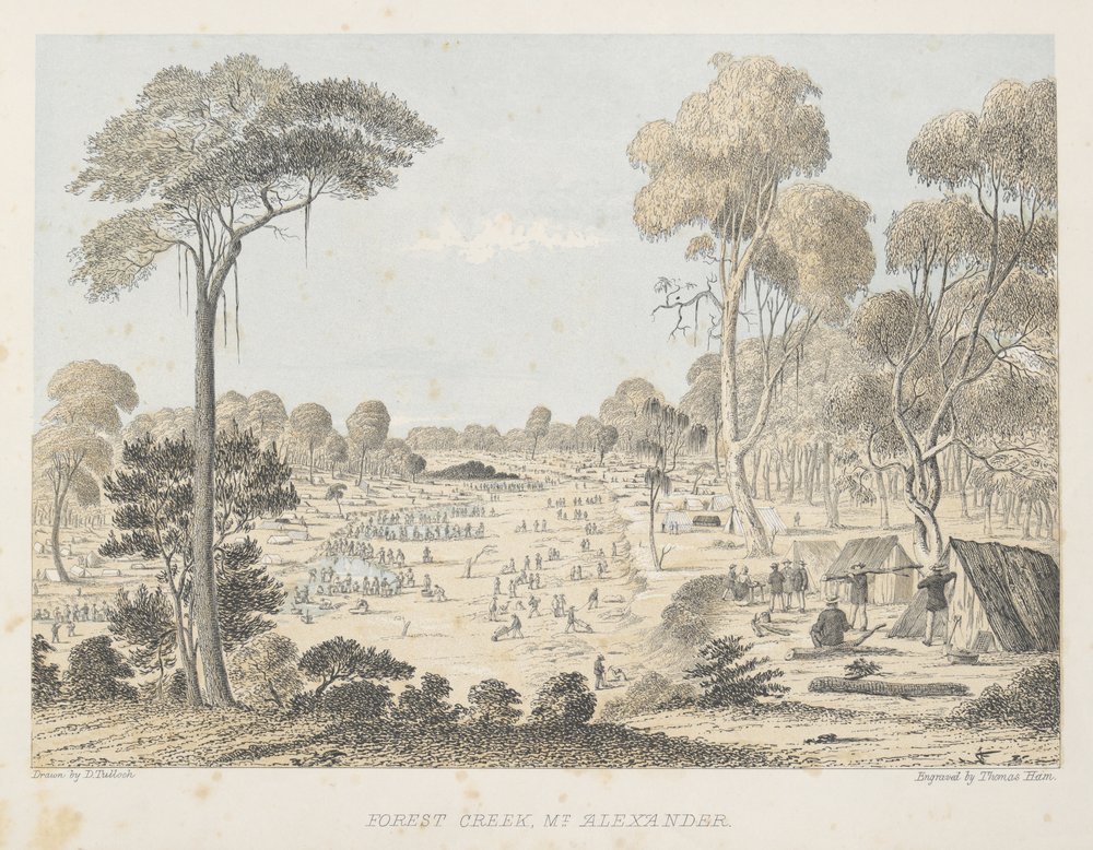
Surfacing at Forest Creek, Mt Alexander, 1852. Ham, T., & Tulloch, D. Source: State Library Victoria
The image above shows many diggers at work removing the surface layer and digging shallow shafts, then carting it down to the creek to be washed using puddling tubs, cradles and tin dishes.
Surfacing at Mt Alexander was mentioned in 1851:
"Gold still continues in abundance, and all parties appear to be doing well. The surface washing is prolific as ever, and the quantity of gold found is almost incredible. I fully expect the next escort will bring down even more than the last." (Source: Trove)
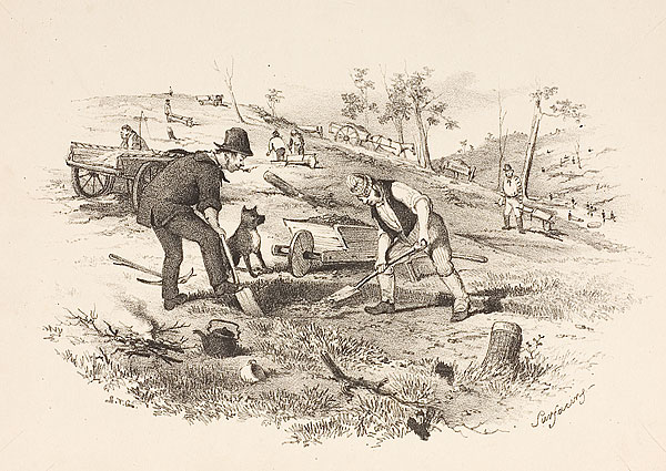
Surfacing, S.T. Gill, 1852. Source: National Gallery of Australia.
Surfacing near Ballarat was described enthusiastically in 1853:
"The last few days have witnessed the opening and successful working of the largest and richest field of surfacing ever found in this district ... the sinking is from three to six feet in depth, with plenty of water. The gold is found from the surface to the bottom, but, of course, the nearer to the latter, the more abundant it is. It is rather patchy, but everybody is getting something, and to my certain knowledge upwards of 100 ozs have been taken from one claim less than four feet deep, and yesterday 19 ozs were washed from two tubs from another." (Source: Trove)
Many miners during the gold rush would readily abandoned their diggings in favour of the next area being rushed, and not necessarily because their current claim had been completely worked out.
A surfacing field at Stoney Creek was prematurely abandoned in 1856 due to "water becoming scarce, and the gold not lying about quite so plentiful as potatoes in a field" (source: Trove).
That particular ground actually turned out to be very rich and was soon picked back up by another rush, but it certainly illustrates the haste with which the miners would abandon an area in favour of a richer or easier field nearby.
This was a time when gold nuggets weighing several ounces were considered small.
On her journey to the diggings in 1852, Ellen Clacy wrote that her shipmates found three "small" nuggets weighing two to four ounces each! (Source: A Lady's Visit to the Gold Diggings of Australia, 1852-53).
Many of the diggings which were considered unfavourable back then would be celebrated by any recreational prospector today.
Gold prospecting around surfaced areas
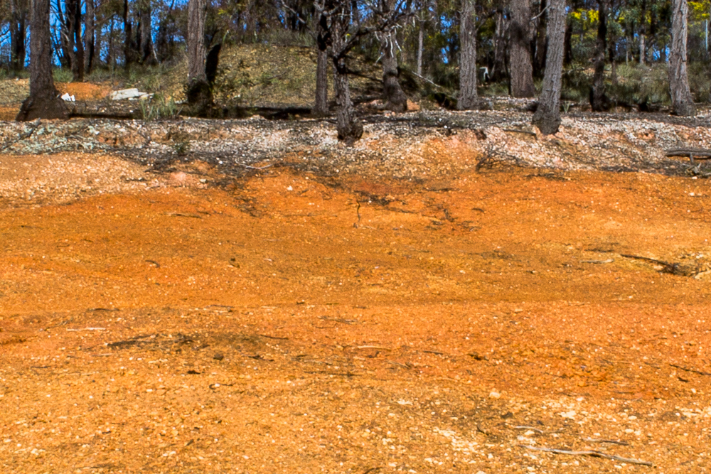
The distinct edge where the surfacing work stopped.
Although they have been worked, reworked, and gone over by modern prospectors, the ground around the edges of the surfaced areas can still contain plenty of gold.
These edges are usually very distinct and easily recognised, as seen in the image above.
You may pick up gold using detectors in the shallow ground surrounding the surfacing, or if you feel like putting some work in with a shovel there is usually plenty of fine gold to be recovered through sluicing.
Many surfaced areas will have a dam and old puddling site close by, so water for highbankers may be available.
The old timers used puddlers in these areas for a reason though - you will need to break the clay up before running it through a sluice or a lot of gold will remain trapped in clumps of clay and be washed away.
You could slurry it up in a tub of water before running it through your sluice, or use a trommel with angle iron attached inside the barrel to help break up the clay as it washes through.
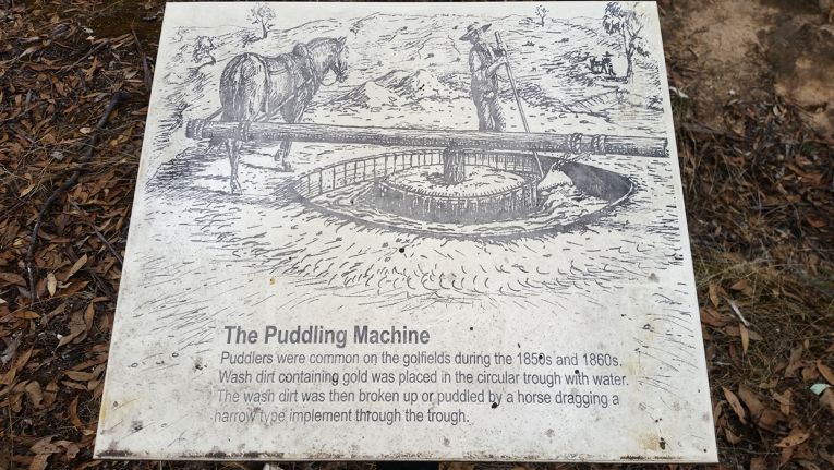
An illustrated sign at the Bull Gully Battery Dam and Eucalyptus Distillery depicts a miner working his puddling machine to separate gold from the clay.
How to find surfaced areas
Evidence of surfacing can be easily spotted from above.
A search around Victoria's Golden Triangle using Google Maps' satellite view can reveal some large surfaced areas.
Look for the conspicuous red/orange colour of stripped bedrock, usually barren areas which contain sparse vegetation.
Famous surfaced area in Moliagul VIC, Google Maps satellite image.
The surfaced area shown in the image above is where the world's largest alluvial gold nugget, "Welcome Stranger" was discovered within mere inches of the surface in 1869.
The square structure you can see towards the top of the surfacing is the monument which commemorates the discovery. The site now hosts a fantastic picnic area and discovery walk.
Hydraulic sluicing

Monitor used in hydraulic sluicing. Forest Creek Historic Gold Diggings, Castlemaine VIC
Another method of stripping the ground down to bedrock was "hydraulic sluicing", where jets of high pressure water were used to blast the deposits from the surface and wash them down to be processed for gold.
There is a fantastic example of a hydraulic sluicing site at the Forest Creek Historic Gold Diggings in Castlemaine.
Another remarkable example is found at the Pink Cliffs Geological Reserve in Heathcote.
SEE ALSO
- Guide to gold prospecting in the Victorian Goldfields
- Places to prospect in the Victorian Goldfields
- Gold-bearing creeks and rivers in Victoria
- Historical gold maps of the Victorian Goldfields
- Gold prospecting maps for Victoria's State and National Parks
- Researching gold prospecting and history - online resources
- Gold shops, detector hire and gold tours in the Victorian Goldfields
- YouTube channels from the Victorian Goldfields
- Dangers of mine shafts in the Victorian Goldfields

