The Victorian Goldfields region is world-famous for the size and abundance of its alluvial gold.
Gold fever has gripped the state since 1851, and with significant discoveries still regularly hitting the news, the region's proud gold prospecting heritage is still going strong today!
One of the best ways to spend a weekend in the Victorian Goldfields is to set up camp and settle in for weekend of gold detecting, panning or sluicing.
I know I'm always on the lookout for free campgrounds near me, so I thought I'd put together this handy list.
Check out this collection of campgrounds throughout the region which make perfect destinations for a gold prospecting trip.
Notley Campground, Whipstick VIC

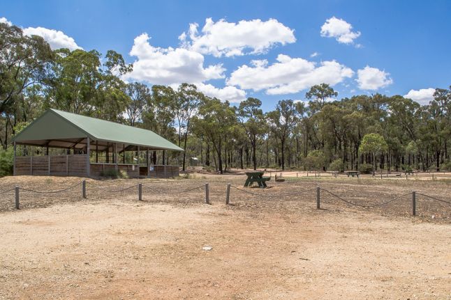
Explore the natural and historical treasures of the Whipstick area from Notleys, a fantastic free camping area within the Greater Bendigo National Park.
This area is popular for bushwalking and gold prospecting. Visitor facilities include picnic tables, a large picnic shelter, wood fire barbecues, toilets and walking tracks.
Surface Point Picnic Area, Enfield VIC

Set up camp at Surface Point and spend a weekend exploring the fascinating landscape and history of the Enfield State Park.
Set above the seasonal Mount Misery Creek with views across the surrounding bushland, this is a great area for bushwalking and gold prospecting.
The free campground features a picnic table and wood fire barbecues, with several campsites suitable for tents located around the gravel parking area.
Mount Misery Creek is very seasonal and rarely has running water. If you're planning on gold panning, this creek is best to visit after heavy rains and during the winter months.
Slaty Creek, Creswick VIC

Slaty Creek in Creswick is a popular destination for gold prospectors due to the three free campgrounds along the creek and the extensive surrounding forest for gold detecting.
Slaty Creek is a great place to bring the family on a casual trip for easy access to a gold panning creek from the campsite.
Prospectors may prefer to find a spot on the creek further from the campground, as the area around camp is very regularly worked for gold.
Slaty Creek is a shallow, seasonal creek which will dry up during summer (but retains puddles here and there after summer rains).
Paddys Ranges, near Maryborough VIC

Paddys Ranges Campground is located within Paddys Ranges State Park, a beautiful Box-Ironbark forest which has over 230 species of wildflowers.
The large campground includes multiple picnic tables, fire pits and wood fire BBQs, an information shelter, and a toilet block.
Gold prospecting is permitted within designated areas of Paddys Ranges State Park (see Parks Victoria's prospecting map for Paddys Ranges).
Ironbark Dam, Kingower VIC

Set up camp for a weekend of bushwalking and gold prospecting in the Kingower State Forest, alongside the small Ironbark Dam and right by the historical Ironbark Gully gold diggings.
Several picnic tables and wood fire barbecues are spread out around the dam, and there is plenty of space to pitch tents or park caravans.
The areas around Kingower, Inglewood and Wedderburn are famous for their history of massive gold discoveries, including the unforgettable Hand of Faith gold nugget!
Rush Dam Camping Area, Kamarooka VIC

This basic free camping area sits alongside Rush Dam in the Greater Bendigo National Park, featuring a single picnic table and wood fire barbecue.
There are lots of clear areas around this spot to set up camp, and the area is popular for gold prospecting.
The interesting remains of a gold puddling machine lies directly beside the picnic area.
Bush Camp and Gold Puddlers, Percydale VIC

This basic informal bush camp is comprised of a flat clearing alongside the intersection of Fiddlers and Slate Quarry Tracks in Percydale.
A basic fire pit sits in the middle of the clearing, along with some large logs which make good seating.
The remains of two gold puddling machines are right alongside the campsite up on a rise, with a small mining dam located just beyond them (often empty).
The Percydale area has a rich mining history and is popular for gold prospecting.
Hard Hill Tourist Reserve, Wedderburn VIC

The Hard Hill Tourist Reserve in Wedderburn is an excellent free campground filled with interesting historical features.
Explore gold rush history as you stroll through the reserve and discover a reconstructed gold puddler, a stamp battery by the entrance, and a mine adit atop the hill.
Visitor facilities at Hard Hill include wood fire barbecues, undercover picnic area, large separate undercover area, toilets and showers (for campers' use only), walking tracks and lots of information signs.
There is plenty of space to set up camp in the peaceful bushland setting, which is also RV friendly. Check out our gold prospecting guide for Inglewood and Wedderburn.
Warburtons Bridge Campground, Glenluce VIC

Located within a bend of the scenic Loddon River, Warburtons Bridge in Glenluce is a spacious campground featuring multiple picnic tables, wood fire barbecues, fire pits and a toilet.
Campsites sit right alongside the river with views of some beautiful rocky outcrops on the surrounding hillsides.
Warburtons Bridge is located within the Castlemaine Diggings National Heritage Park which harbours and protects culturally significant landscape and relics of the Victorian gold rush.
During the gold rush, thousands upon thousands of people rushed to this area (then known as the Mount Alexander Diggings) seeking to strike their fortune on one of the richest shallow alluvial goldfields in the world!
The region remains a popular destination for gold prospecting to this day.
Stoney Creek Track Campground, Stony Creek VIC

The Stoney Creek Track Campground is located within the Caralulup Nature Conservation Reserve, a large area of bushland between Talbot, Caralulup and Stony Creek.
The campground is located alongside Stoney Creek Track, where a fenced area contains a picnic table and wood fire barbecue. There is a dam located behind the camping area.
The Caralulup Nature Conservation Reserve is popular for gold prospecting and is filled with extensive evidence of historical gold workings.
Chokem Flat Campground, Irishtown VIC

Chokem Flat is a free bush campground set along Fryers Creek, where a huge clearing provides plenty of room for tents, caravans, RVs, and camper trailers.
The only camping facilities present at Chokem Flat are a brick fire pit and a basic wooden table with no seating.
Chokem Flat is located within the fascinating Castlemaine Diggings National Heritage Park, which harbours and protects culturally significant landscape and relics of the Victorian gold rush.
During the gold rush, thousands upon thousands of people rushed to this area (then known as the Mount Alexander Diggings) seeking to strike their fortune on one of the richest shallow alluvial goldfields in the world!
The region remains a popular destination for gold prospecting to this day.
Gold prospecting is allowed in the seasonal Fryers Creek, which runs alongside the campground.
Red, White and Blue Recreation Area, Muckleford VIC

The Red, White and Blue Mine in the Muckleford State Forest is a fascinating place, great for camping, bushwalking and gold prospecting.
The historic mine is a sight to behold, with an intact poppet head, a mine shaft, machinery site, mullock heap and dams. The poppet head was originally from the Bendigo Deborah United Mine.
There are multiple picnic tables scattered around the area, each with its own wood fire barbecue. Several tables have great views over the water of the dams.
Butts Reserve, Maldon VIC

Butts Reserve is a great campground beneath Mt Tarrengower, featuring picnic tables, wood fire barbecues, bins, toilets, and water taps.
There is also a large undercover area with a concrete floor located separate to the picnic area. Campsites are scattered through a lightly treed area and surrounded by hillsides of huge boulders.
There is lots of fascinating gold history throughout the Maldon Historic Area, and it's a great location for gold prospecting and bushwalking.
Moliagul Campground, Moliagul VIC

This excellent campground in Moliagul is equipped with an undercover BBQ area, picnic tables, toilets and rubbish bins.
The area is extremely popular for gold prospecting.
The world's largest alluvial gold nugget ever discovered in the world was unearthed here in Moliagul in 1869 by two lucky Cornish miners. Click here to read more about the famous Welcome Stranger nugget and its discovery.
You can also explore the very spot where the Welcome Stranger was discovered, now an excellent picnic area and discovery walk.
Waanyarra Recreation Site, Waanyarra VIC

The Waanyarra Recreation Site is a large campground in the Dunolly State Forest which is great for gold prospecting, bushwalking and cycling.
There is a designated picnic area which contains picnic tables, a double wood fire barbeque, seating and an undercover area.
Outside the picnic area are clearings for camping. The ground is clear, flat and easily accessible by caravans.
The Waanyarra area is popular for gold prospecting and is filled with fascinating history, including Morton's Welcome Inn, the historical Waanyarra Cemetery, the nearby Early Burial Ground, and Murderers Hill.
The areas close to the campground have been extensively worked by gold prospectors, but this campground makes a great base for prospecting in the wider Dunolly / Tarnagulla areas.
PROSPECTORS AND MINERS ASSOCIATION VICTORIA
Established in 1980, the Prospectors and Miners Association of Victoria is a voluntary body created to protect the rights and opportunities of those who wish to prospect, fossick or mine in the State of Victoria, Australia.
You can support the PMAV in their fight to uphold these rights by becoming a member. You'll also gain access to exclusive publications, field days, prospecting tips, discounts and competitions.
DISCOVER MORE GOLD RESOURCES ON GOLDFIELDS GUIDE
- Guide to gold prospecting in the Victorian Goldfields
- Ballarat gold prospecting guide
- Castlemaine gold prospecting guide
- Maryborough gold prospecting guide
- Dunolly and Moliagul gold prospecting guide
- Inglewood and Wedderburn gold prospecting guide
- Places to prospect in the Victorian Goldfields
- Interactive map showing lots of places to prospect in the Victorian Goldfields
- Gold-bearing creeks and rivers in Victoria
- Crevicing for gold in creeks and rivers
- Researching gold prospecting and history - online resources
- Surfacing in the Victorian Goldfields
- Gold shops, detector hire and gold tours in the Victorian Goldfields
- YouTube channels from the Victorian Goldfields
- Dangers of mine shafts in the Victorian Goldfields
- Online directory of Victorian gold maps
- Gold prospecting maps for Victoria's State and National Parks
- Historical gold maps of the Victorian Goldfields
- How to read historical gold maps
- Gold history locations on Goldfields Guide


