Browse by Tag
BBQ
Educational
Free camping
Gold history
Gold prospecting
Swimming
Walking track
Search

Simson Historic Area

  • 20170419 171343
  • 20170419 171658
  • 20170419 171730
  • 20170419 171741
  • 20170419 171812
  • 20170419 171849
  • 20170419 172157
  • 20170419 171356
  • 20170419 171407
Simson Road W, Havelock VIC 3465

Explore other locations around this area using our interactive map

Features

The Simson Historic Area is a patch of bushland which runs alongside the Maryborough-Dunolly Road. 

It has been heavily explored by gold diggers, as is evidenced by the countless mine holes scattered densely throughout the area.


There is a 4WD road/walking track winding through, access from Simson Road W. 

Be careful when walking that you don't trip or fall, as the ground is very uneven.


GEOLOGICAL MAP OF THE MARYBOROUGH GOLD FIELD, EARLY 20TH CENTURY


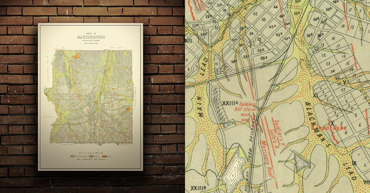
Geological map of the Maryborough gold field which shows historical features in superb detail, including reefs, leads, gullies/flats, and old workings. Originally published by the Department of Crown Lands and Survey, early 20th century. High quality, durable A1 print in a satin finish. Large, 594 x 891 mm. Go to online shop.


DID YOU KNOW...

  • Bushwalking is an excellent way to get outdoors and exploring nature.
 

Comments

No comments

Leave a comment

Follow us on Facebook